2020 census reveals losses for Ohio while redistricting efforts are still set for later this year
May 1, 2021
Data from 2020’s census was released on April 26 and reveals Ohio is losing one congressional seat and an Electoral College vote.
Ohio’s population grew by 2.3 percent from 2010 to 2020 while the country as a whole grew by 7.4 percent. This loss seems to affect several states in the Midwest with Michigan, Illinois, Pennsylvania and West Virginia each losing a congressional seat too.
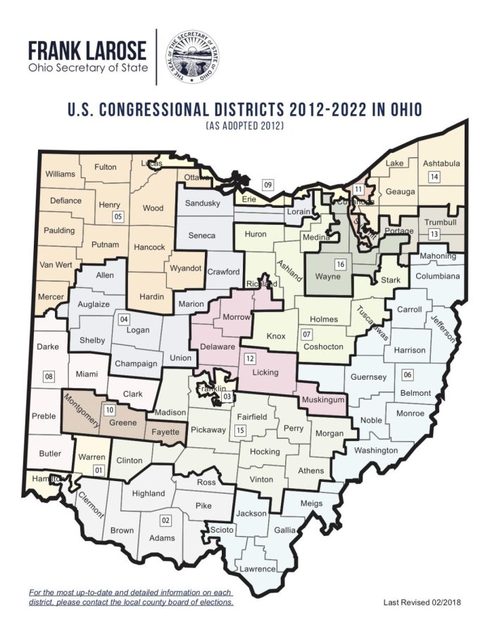
Ohio’s new congressional district map is also set to be drawn this year using 2020’s census data, despite delays largely due to COVID-19. The U.S. Census Bureau was originally supposed to give states their updated redistricting data by April 1, but they were informed in February that updated state redistricting data would be delivered by Sept. 30.
In 2018, voters in the state bipartisan approved the Congressional Redistricting Procedures Amendment, changing the vote requirements to pass congressional redistricting maps and the standards used in congressional redistricting.
Gerrymandering is a practice intended to establish an unfair political advantage for a particular party or group by manipulating the boundaries of electoral districts. Ohio’s districting was officially deemed unconstitutional by a panel of federal judges in 2019.
Republicans have held a supermajority in both state chambers of the Ohio General Assembly for the past decade. The 2018 referendum, which voters approved, is intended to create more competitive elections across legislative and congressional lines.
Anti-gerrymandering measures were introduced during two Ohio elections as a way to counter what has been called “unconstitutional gerrymandering” by voter activists and Democratic politicians.
The state legislature was supposed to propose the redistricted map by Oct. 31, but this has been delayed with no updated timeframe. In order for it to be implemented, half of each party in the legislature has to approve the new map. If this vote passes, the map goes into effect for 10 years starting in 2022.
If this vote fails, new districts are to be drawn by the majority party. In the past, these districts would have been valid for 10 years. However, due to the changes voted on in 2018, if the dominant party has to redraw the lines, that map is only valid for four years.
With large bipartisan support for these new amendments, voting rights groups claim the practice will start to be undone.
“It’s a really good sign that the legislature is finally taking this seriously and had a good plan to end it,” Deborah Barber, president of the Kent League of Women Voters, said.
The League of Women Voters of the U.S. “encourages informed and active participation in government, works to increase understanding of major public policy issues, and influences public policy through education and advocacy,” according to its website.
In the state legislature, Portage County is divided into two districts. The southern district, District 75, stands alone while the northern portion, District 76, was joined with Geauga.
In the Ohio Senate, parts of Lake County are also included. Barber says the effects of this districting have effectively disenfranchised the minority party’s vote.
“No one who believes in the principles of democracy upon which this country was founded should tolerate gerrymandering,” Barber said. “I say it’s time, finally, to do the right thing.”
However, with the census’s delays, state legislators might not be able to pull this off in time unless planning, logistics and motivation are put in place immediately, she said.
“Otherwise, they have an out which will leave the status quo in place for four more years. That is unacceptable and voters should demand action,” Barber said.
Ian Jameson covers the Statehouse. Contact him at [email protected].