Mapping May 4 project connects history to its location
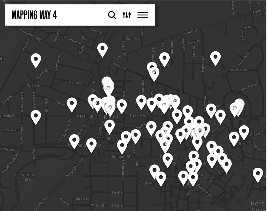
Photo courtesy of the Mapping May 4 website.
May 4, 2023
The Mapping of May 4 website expanded to local places in Kent to display an archive map of May 4. The project aims to make May 4 history immersive.
Sara Koopman is an Assistant Professor and geographer in the Peace Studies Department. Koopman and her colleague Jennifer Mapes created and developed the Mapping of May 4.
“I did this project with Jennifer Mapes. She is the one that brings the map-making experience and skills,” said Koopman. “We are both geographers, but she is also a cartographer, meaning she makes the maps. I am a political geographer interested in the relationship between power and place.”
The Mapping of May 4 is a website, and it takes short audio clips of stories from oral histories in the Kent State archives and puts them on a map. It covers the historical events between May 1 and May 5, 1970.
“The other thing that I would like to emphasize is that it also includes self-guided walking tours,” said Koopman, “where you can listen as you walk to stories about the particular places where you’re standing. It includes stories both on campus and across town.”
Koopman said the idea sparked as she was initially from Toronto, Canada. In Toronto, there were walking tour apps on people’s trauma in history.
“My colleague had said something about wanting to do some kind of map of May 4, and I said, oh, we should map the stories, and so we just go riffing,” said Koopman. “She said there are stories and archives, but they are super long, and nobody reads them. So maybe people would be more likely to read them if there was a short snippet of a story about their dorm room or building where their class is.”
Koopman said they had to decode and figure out specific stories’ locations. Some stories would reference the location as a restaurant without implying what restaurant.
“My hope was that if we felt some sense of connection through place, like my dorm or classroom, it would help us build connections across differences, ” said Koopman. “So that we would be more likely to read a story we might not otherwise read. I think we have ways to build reconciliation in this community.”
Koopman said some viewers are uncomfortable with the online version, so they came up with offline components.
“We also have several offline components. There’s a whole wall that is a map. At the visitors center outside the hallway, with little push buttons,” said Koopman. “You can push the buttons and hear the stories. There is also a map like that in town at the Historical Society Museum.”
She also said the comment section was invented for the students and people to comment about the amazement of changes over time.
“You can comment on the bottom and add your own story or photograph. I really hoped we would get more comments, and it’s one of the disappointments,” said Koopman. “I think many people think they have to live through the 1970s to comment. But we would love comments like, ‘Wow, now this is a Starbucks.’”
Koopman said reaching a broad audience was important.
“The look and feel of it was important to us that it be accessible not just to students but also the generation of survivors who were shot at or who were at grad school at the time.”
Annalexis Davis is a reporter. Contact her at [email protected].