The Great Lakes just set a record for lack of ice
January 22, 2021
(CNN) — Most years, by January the majority of the Great Lakes are so cold they look like a scene from “Frozen.” This year, that’s not the case.
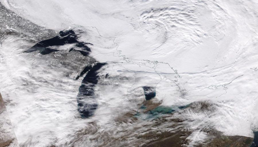
In fact, the Great Lakes are currently dealing with record low ice. According to the Great Lakes Environmental Research Laboratory (GLERL), the Great Lakes total ice coverage right now is sitting at 3.9%. This same time last year, it was sitting at 11.3%, and the year before at 18.5%.
The previous record low for this date was 5% back in 2002.
This is good news for most people from an economic standpoint. When the lakes completely freeze over, barges can no longer move through the lake, which has a big economic impact.
However, Dr. Jia Wang, a physical oceanographer for NOAA-GLERL, said it’s not necessarily a good thing ecologically if the lakes remain unfrozen.
“For some species, no ice cover is not good for them because they need a safe place to lay eggs,” Wang said.
The reason for this lack of widespread ice coverage is due to the lack of extremely cold air across the region.
Since January 1, much of the Midwest and Northeast — including Minneapolis, Chicago, Cleveland and Buffalo — have had air temperatures at least 5 to 10 degrees above average.
With no real robust areas of cold air in the future, the long-term forecast for Great Lakes ice coverage also looks meek.
“The Great Lakes region is experiencing warmer-than-usual weather, and the max ice cover is projected to be 30%, way below the average of 53%,” Wang said.
That means by the end of winter, less than one-third of the Great Lakes will be covered by ice.
In order to build significant ice over the lakes, a blast of cold air needs to settle in — but the long-term forecast does not reflect that.
The one-month outlook from NOAA shows warmer than average temperatures to settle in across much of the country.
Ice, ice, baby
Lake-effect snow is prevalent at the end of fall and early winter, but usually by January, it starts to ease up, thanks to the lakes themselves freezing over.
“Like a hurricane in the ocean, the water in the Great Lakes is the “fuel” for lake effect snow,” said CNN Meteorologist Dave Hennen.
“When the lakes are completely ice covered, that moisture isn’t available and it effectively shuts down the development of snow.”
In order for lake-effect snow to form you need very cold air to pass over the much warmer water of the lake. This causes some of that lake water to evaporate and warm the air above the lake. Winds push that moist air away from the lake and onto land. As that air moves, it cools and sinks back to the ground, dumping that moisture which is now in the form of snow.
Lake-effect is really generated by the temperature difference between the water and the air. If it’s been significantly warmer in the Northeast than usual, that could also be reducing the amount of lake-effect snow.
“Temperature departures from normal in the eastern Great Lakes have been running 5 to 7 degrees above normal since the first of the year,” said CNN Meteorologist Chad Myers. “This significantly reduces the opportunities for lake-effect snow.”
In addition to the milder temperatures across much of the northern US, there hasn’t been a big amplified jet stream this year — and both of those are limiting snow systems from moving through the region.
That doesn’t mean there isn’t snow, there just isn’t as much as usual.
Marquette, Michigan, has had nearly 70 inches of snow so far this season, which is 30 inches below normal. Buffalo, New York, has had nearly 40 inches of snow so far, but that is over a foot below normal.
Grand Rapids, Michigan, and Rochester, New York, have both experienced snow levels over 30 inches below normal for the season, despite both already picking up at least 16 inches so far this season.
Great Lakes were warmer last summer, too
Current temperature above the lakes only tell a portion of the story.
Last summer, the Great Lakes were exceptionally warm, and bodies of water retain heat much longer than land. Lakes Michigan, Erie, Huron and Ontario were each about 5-10 degrees above average.
Even Lake Superior was at least 5 degrees above average, although no one probably thinks of 55 degrees (their July temperature) as being particularly warm for water.
“In fact, water temperatures on Lake Eerie had even neared 80 degrees in July, besting current sea surface temperatures off the coast of Hilo, Hawaii at the time,” said CNN Meteorologist Pedram Javaheri.
More importantly, it was well ahead of the typical peak of Great Lakes warmth, which usually occurs in mid August.
“In mid-July, the water temperature in Lake Erie climbed to over 79 degrees, significantly warmer than its 72 degrees average for that time of year,” Javaheri said.
“While Lake Ontario sat at an average water temperature of around 77 degrees, well above its normal of 67 for mid July. These current lake temperatures of 77 to 79 degrees have only occurred one other time across lakes Erie and Ontario since records began. It was during the infamous deadly summer heatwaves of 1995 when in August of that year the two lakes soared to such values.”
Record-setting warmth settled in early across the northern reaches of the Northern Hemisphere and that heat settled into the Great Lakes, which is still influencing the weather today.
The-CNN-Wire
™ & © 2021 Cable News Network, Inc., a WarnerMedia Company. All rights reserved.


