


CNN — A newly-formed tropical depression in the Atlantic Ocean has become Tropical Storm Lee and is expected to strengthen into a major hurricane by Thursday as the season approaches its typical peak in early September.
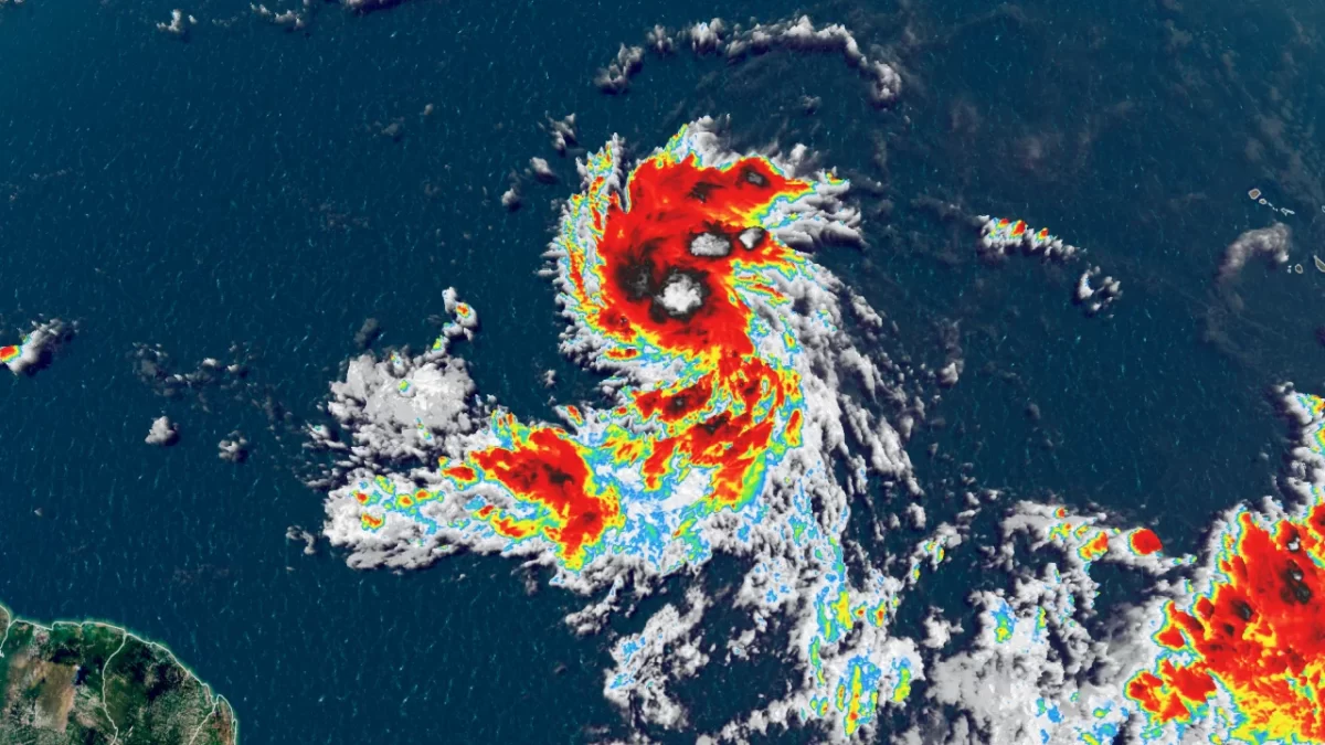
Tropical Depression 13 formed Tuesday morning in the central tropical Atlantic, almost 1,000 miles west-southwest of the Cabo Verde Islands, according to the National Hurricane Center.
The depression strengthened into a tropical storm later Tuesday, the National Hurricane Center said in a 5 p.m. update. Lee is forecast to strengthen into a major hurricane by Friday before it reaches Category 4 strength by Saturday, the update said.
Tropical Storm Lee has winds of 45 mph with higher gusts and is moving west-northwest at 16 mph.
“Lee is forecast to become a major hurricane by this weekend and could bring impacts to the Leeward Islands by that time. While it is too soon to determine the location and magnitude of these possible impacts, interests in this area should monitor the progress of Lee and further updates to the forecast,” the hurricane center warned.
As the depression moves steadily west-northwest this week, it will enter conditions increasingly favorable for strengthening: Plenty of moisture, low wind shear and abnormally warm water stretch nearly the entire length of the potential cyclone’s projected path.
“The NHC intensity forecast is extremely bullish for a first forecast, but remarkably lies below the intensity consensus,” the National Hurricane Center’s storm discussion said. “All indications are that the depression will become a strong hurricane by the end of the forecast period.”
The system is forecast to become a hurricane as early as Thursday and would be the fourth to reach that status this season, following Don, Franklin and Idalia. The hurricane is expected to grow significantly stronger by the weekend and is forecast to become the season’s third Category 3 or stronger hurricane as the weekend begins.
It will track generally west-northwest across the tropical Atlantic through the end of the week and make a close pass at the Leeward Islands over the weekend as a hurricane. Any shifts along its track as it nears the islands could bring more of an impact there and beyond. Anyone in the eastern Caribbean – including the Leeward Islands, Puerto Rico and Hispaniola – as well as the Bahamas will need to keep a close eye on the forecast.
It’s too soon to know whether or not this system will directly impact the US mainland, but even if the hurricane stays out to sea, dangerous surf and rip currents could once again threaten the East Coast. One person was killed in a rip current in New Jersey over the Labor Day weekend.

Sunday, September 10, is the climatological peak of Atlantic hurricane season, when the basin is at its busiest on average. A flurry of tropical activity surrounding this date is not out of the ordinary, but it can turn hazardous fast.
The 2023 Atlantic season has already been busy: It is tracking above average for a number of different metrics including number of named storms, number of hurricanes and number of major hurricanes, according to Philip Klotzbach a research scientist at Colorado State University.
CNN’s Robert Shackelford contributed to this report.