Severe weather in Kent signifies the start of Tornado Season
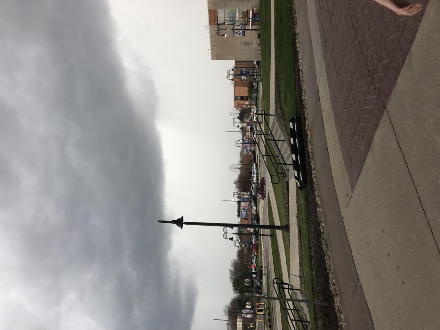
Dark clouds form over Kent’s main campus on Sunday, April 14th.
April 15, 2019
Much of Ohio was under tornado watches or warnings following severe thunderstorms across the midwest Sunday night.
Dean Tunberg, who spent two decades as a meteorologist for the U.S. Navy, expected tornado activity to begin in our area.
“We are susceptible to tornadoes because to the north we have Canada, and Canada brings a lot of cold air down,” says Tunberg. “And to the south, we have the Gulf of Mexico and that brings up a lot of low level, warm moisture – and when you get the mixing of those two elements, specifically in spring, is what causes the supercells to form.”
Tornadoes are created by supercell thunderstorms, characterized by rotating updrafts, winds at least 58 miles per hour and/or hail exceeding one inch in diameter. When hot and cold fronts clash in the atmosphere over Northeast Ohio and the flat midwest, supercells can develop that then have the potential to become tornadoes.
Portage County, along with much of Ohio, was put under a tornado watch at about 4:40pm Sunday afternoon. That watch was upgraded to a warning as conditions worsened.
A tornado watch is issued when the atmospheric conditions indicate the potential for a tornado to form. Tornado warnings are put into effect when a tornado has been indicated by weather radar or sightings have been reported.
Students at Kent State’s main campus were first notified of the severe weather from alerts on their phones and tornado sirens being sounded outside. Loudspeakers in residence halls and campus buildings played a message from the campus emergency alert system that urged them to seek shelter.
Freshman Shauna Williams was in Olson Hall when she found out about the severe weather headed our way.
“I got a text on my emergency alert about 10 minutes before the hall sirens and the emergency warning started going off,” says Williams. “We all had to go down to the first floor wing and sit in a hallway. We weren’t allowed on the furniture or by the windows or anything.”
The Kent State Police Department and their dispatchers make the call on when to alert students and faculty of imminent threats. According to Officer Tricia Knoles, the dispatchers can activate the tornado sirens and send out Flash Alerts. Once campus has been notified, University Communications and Marketing takes over and adds updates as they learn more about the emergency situation.
Knoles and the Kent State Police urge students and their families to sign up for Flash Alerts. Up to five phone numbers can be registered to a student’s account to ensure that everyone knows about severe weather and other emergencies on campus.
Maddy Haberberger is a TV2 reporter. Contact her at [email protected].