


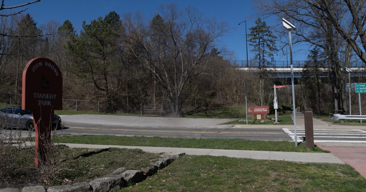
Just across the river on Stow Street, approximately three-quarters of a mile from the Kent State University campus lies the confluence of the three prettiest places in Kent.
Franklin Mills Riveredge Park is on the north side of Stow Street, John Brown Tannery Park is to the south, and the Portage Hike & Bike Trail runs through the area.
The main section of the Portage Hike & Bike Trail starts in Ravenna on Peck Road near State Route 88, continues through northern Ravenna, connected to Historic Downtown Ravenna, and continues along old rail lines through Towners Woods Park, past Beckwith Orchard before coming to a temporary end at Brady’s Leap Riverwalk at the Stone Arch Bridge, which carries Main Street.
The trail then diverts up the stairs to Main Street and goes across the bridge before turning south on Franklin Avenue. Once on Franklin, the trail diverts two directions: turning left up a path on the south side of the Haymaker Parkway bridge up to the corner at Water Street and Haymaker, before connecting with the Lester Lefton Esplanade and proceeding through Kent State University to Dix Stadium, or turning right onto Summit Street, crossing a bridge, where Summit Street becomes Stow Street, and joining up at Franklin Mills Riveredge Park and heading south through John Brown Tannery Park, and onto the University of Akron, where it will eventually join up with the Ohio & Erie Canal Towpath Trail via the Freedom Trail.
Franklin Mills Riveredge Park received an “expansion” in 1998, designated Heritage Park when the Ohio EPA introduced the removal of the Kent Dam to improve water quality. However, the Kent Dam is a historical piece of Kent, placed on the National Register of Historic Places in 1977.
According to the information provided on the Kent City Website, among its archived strategic plans, the Kent Dam is the only known stone arch dam with a similarly constructed sandstone canal lock on one side. Built in 1836, it was declared a “highly engineered structure” for its time.
The dam’s blocks are hand-cut sandstone blocks stacked in an arch 125 feet long and 14 feet high.
Throughout the 20th century, the dam and Franklin Mills Riveredge Park were considered among Kent’s most picturesque places, but the completion of the park’s expansion over the drained dam pool area created yet another picturesque location for families and students to take beautiful pictures under the western arch of the Main Street Stone Bridge as the river rushes past them through the center and eastern arches.
John Brown Tannery Park, the site of a demolished tannery built in 1836 by abolitionist John Brown, sits along the Riverbend with a natural amphitheater and gazebo constructed from the tannery building. It is a beautiful place to listen to the river as it rushes past on a lunch break or between classes.
Tannery Park serves as a trailhead for the Hike and Bike Trail, with several businesses in downtown Kent. The trail continues 2.3 miles to the Freedom Trail’s Middlebury Road Trailhead and the soon-to-be-completed 9.4 miles to the Towpath Trail.
Tannery Park also serves as a trailhead for the Cuyahoga River Water Trail, an 88-mile waterway trail for canoers and kayakers.
To enjoy all three of the prettiest places in Kent, all anyone needs to do is venture down Summit Street, start at Tannery Park, spend some time wandering through the Tannery Labyrinth, head north through Riveredge Park, listen to the rushing of the Cuyahoga River from the lock, snap some pictures under the Stone Arch Bridge, continue north through the Brady’s Leap Riverwalk, and then meander through the myriad of businesses littered through downtown Kent before ending the journey.