


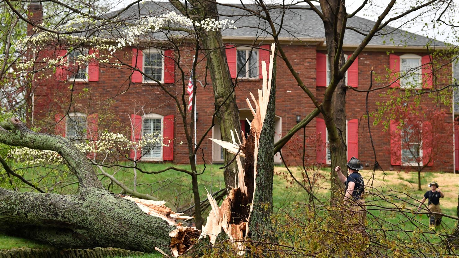
CNN — More than 275,000 homes and businesses across West Virginia, Kentucky, Wisconsin, Ohio, Indiana and Michigan were without power Tuesday night after a powerful system of thunderstorms brought damaging winds, dangerous hail and reported tornadoes to parts of the Ohio Valley.
The damaging storms brought “flooding, downed trees, power outages, and road blockages” across West Virginia, according to Gov. Jim Justice, who declared a state of emergency Tuesday for Fayette, Kanawha, Lincoln and Nicholas counties.
At least 13 homes were damaged and some residents were injured, Fayette County, West Virginia, Office of Emergency Management director Kevin Walker told CNN. The injuries were non-life threatening, Walker said.
“Some are destroyed, and some have major damage,” Walker said.
Fourteen tornadoes have been confirmed Tuesday across Illinois, Kentucky, Ohio, Alabama and Tennessee, the Storm Prediction Center indicates, along with 103 damaging wind reports and 22 hail reports. Just before midnight ET Wednesday, a confirmed tornado was reported in Conyers, Georgia, a city about 25 miles east of Atlanta.
Storms will continue to bring the threat of twisters, strong winds and large hail into the region into early Wednesday, before they shift to the East Coast. Over 35 million people along the East Coast are under threat of severe weather Wednesday, according to the Storm Prediction Center.
A tornado watch is in effect for parts of Georgia and South Carolina until 8 am ET.
The tornado threat is expected to steadily increase after sunset, the center said. In addition to tornadoes, storms will bring a threat of 65 mph wind gusts and hail as large as 1.5 inches in diameter.
At least 128,000 utility customers in West Virginia remained in the dark Tuesday night, according to poweroutage.us.
Damaging winds of 40 to 60 mph battered much of the region and a 92 mph gust was reported in Huntington, West Virginia.
Kentucky Gov. Andy Beshear declared a statewide state of emergency Tuesday as the Lexington area saw “significant damage” from the storms.
“We need all Kentuckians to stay weather aware as we brace for more severe weather,” Beshear said in a press release Tuesday.
In Tennessee, a funeral home and some homes in the town of Sunbright suffered damage from the storm system after it brought two tornadoes to the state on Tuesday, according to Matthew Brown, Director of Morgan County E-911.
Structural damage was also reported throughout Barnsdall, Oklahoma, according to Barnsdall Police, after four tornadoes swept through the state on Monday. Homes were damaged, garages were destroyed and roofs came off some of the houses, Officer Eric Sofian told CNN.
“I was on duty and patrolling the streets when it came through,” he said. “There was a lot of heavy wind, a lot of lightning and I could see a lot of sparks flying from the power lines.”
Three more tornadoes hit Missouri on Monday, per the Storm Prediction Center.
In southern Indiana, multiple vehicles were flipped over “due to high winds or (a) possible tornado” on Interstate 265, Indiana State Police in Sellersburg said, adding minor injuries were reported.
Massive hailstones were reported in Texas, including one as large as 4.5 inches in diameter in Briar – bigger than a softball.
The tornado threat will lessen Wednesday as storms shift east from southern New England to Florida. There is still a Level 2 of 5 risk for severe thunderstorms with damaging winds, hail and even a few isolated tornadoes from the mid-Atlantic to Florida. The worst severe weather is expected midday into the early evening hours.

What to expect this week
A long-duration winter storm will produce significant snow and gusty winds across the Great Lakes and Northeast, the National Weather Service says. Nearly 12 million people – mainly across northern New England – are under winter weather alerts, according to the National Weather Service.
Heavy rain and severe thunderstorms will impact portions of the East Coast Wednesday, according to the National Weather Service. Hazards are possible, with damaging winds and hail being the main threats.
Heavy, wet snow will persist across Wisconsin and Upper Michigan into Thursday. As much as two feet of snow is expected to fall in parts of Northern Wisconsin and Upper Michigan, prompting a blizzard warning.
“Bands of moderate to locally heavy snow will rotate southward into northern parts of the area overnight,” the National Weather Service in Milwaukee said. “Rates will determine where snow may accumulate on roads and cause slippery driving conditions. Gusty north winds may bring broken branches from the wet snow.”
Heavy snow and some sleet will move into northern New York, most of Vermont, New Hampshire and Maine. Snow accumulations of 6 to 14 inches are possible, with sleet accumulations of up to an inch. Significant snow accumulations over 12 inches are likely over northern New York and central New England, according to the weather service.
Some impacts to travel and power outages are expected due to the combination of heavy snow and gusty winds. Whiteout conditions and snow-covered roads could result in hazardous travel conditions in the regions, while the heavy, wet snow and strong wind gusts could cause power outages and downed trees.
Moderate coastal flooding could happen in portions of the Northeast coast late Wednesday through Thursday, the weather service says. That could result in widespread roadway flooding, coastal and bayside flooding, impassable roads and damage to vulnerable structures.
“A strong storm will bring impacts to the area through Thursday,” the National Weather Service in New York said. “Strong to damaging winds, heavy rain, and widespread minor to moderate coastal flooding during times of high tide later Wednesday and early Thursday.”
CNN’s Taylor Ward, Elizabeth Wolfe, Christina Maxouris, Raja Razek, Jamiel Lynch, Brammhi Balarajan, Mary Gilbert and Robert Shackelford contributed to this report.