Cristobal will move into Canada as widespread severe storms impact the Great Lakes region
Cristobal’s remnants are providing a very moist environment for these storms to thrive.
June 10, 2020
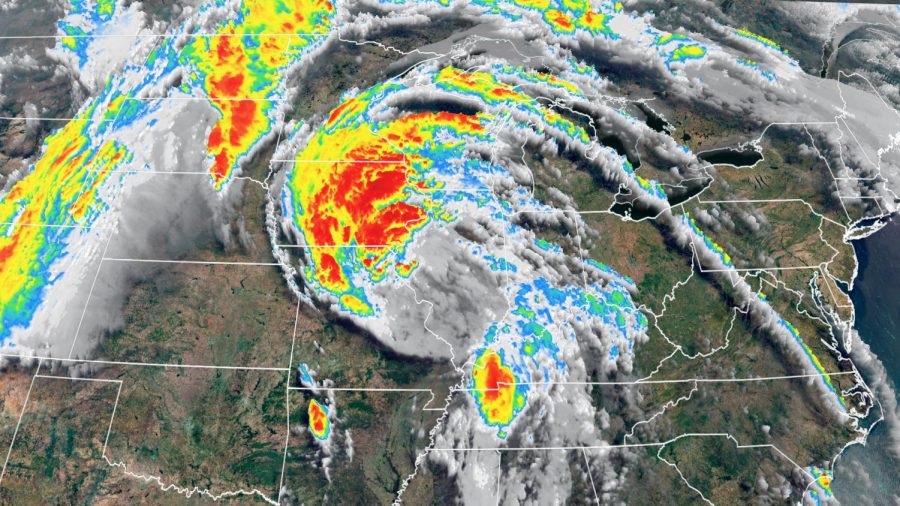
(CNN) — What’s left of Cristobal has survived its long trek up the Mississippi River Valley, causing widespread flooding. Now, Cristobal is heading into Canada as an extra-tropical storm, bringing widespread thunderstorms to the Great Lakes region.
“As the remnants of Cristobal lifts very quickly to the north, the system will bring strong severe storms to portions of the Great Lakes, more specifically Michigan and Ohio this afternoon,” CNN meteorologist Haley Brink says. “Due to the speed of this system, severe damaging winds may be the more widespread threat through the afternoon and evening hours, with tornadoes also possible.”
Cristobal’s remnants are providing a very moist environment for these storms to thrive. And with an advancing cold front right on its heels, the two systems will clash and bring tropical-like storms to the region and a line of strong storms associated with the advancing cold front.
According to the Weather Prediction Center, “a sharp cold front in the wake of Cristobal will spread strong gusty winds and some thunderstorms throughout the Central Plains and Upper Midwest today, and into the Great Lakes through tonight.”
The Storm Prediction Center has issued a moderate risk — level 4 of 5 — for severe thunderstorms, including tornadoes for Wednesday afternoon and tonight.
Over 8 million people are in this risk area, including much of eastern Michigan and northwest Ohio.
A level 3 of 5, enhanced risk cover much of the rest of Ohio, Michigan and into parts of Indiana.
Conditions will improve dramatically by Thursday, with humidity levels coming down and the sunshine returning.
The-CNN-Wire™ & © 2020 Cable News Network, Inc., a WarnerMedia Company. All rights reserved.