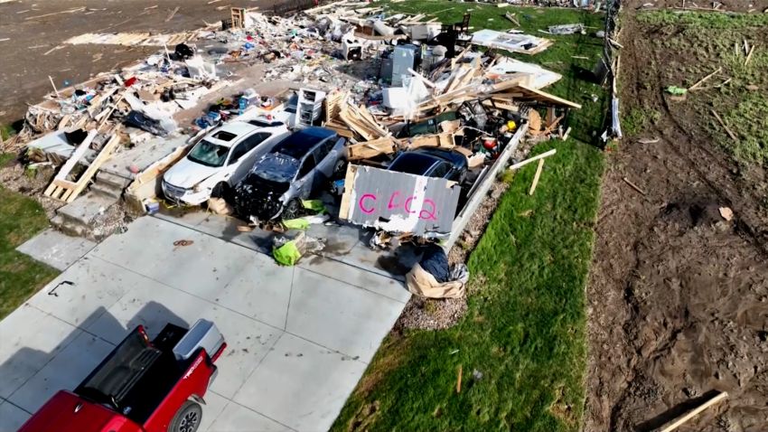


CNN — Another round of severe weather is slamming parts of the South and Mississippi Valley on Tuesday, less than a week after a powerful storm system that swept through the region killed at least three people.
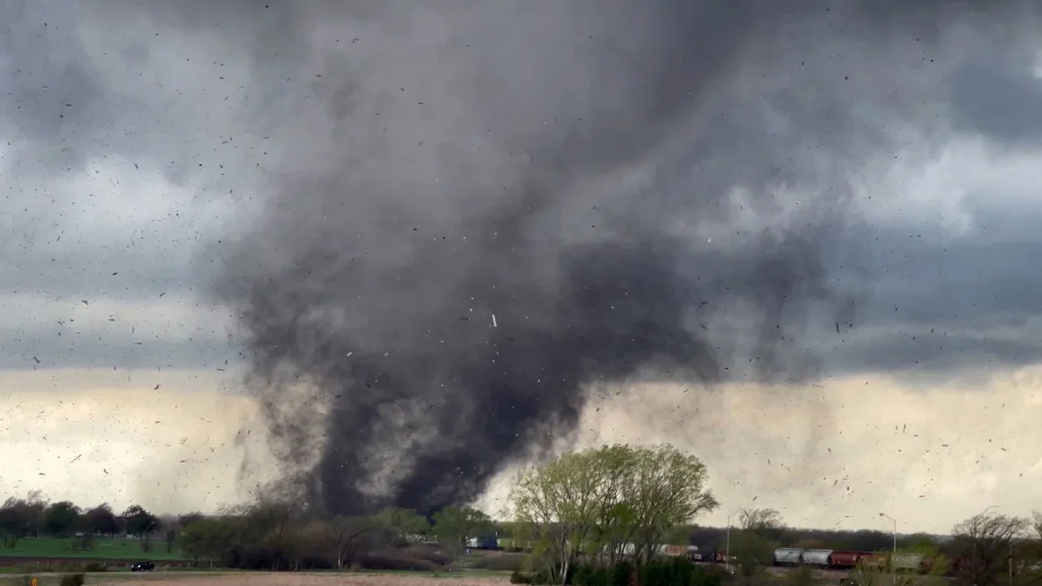
Heavy rain, strong winds and dangerous thunderstorms began Monday in an area from Texas to Alabama, and continuing storms are forecast to unleash a trifecta of dangers Tuesday and Wednesday, threatening tens of millions of Americans across the South and lower Mississippi Valley with more rain, large hail and the potential for strong tornadoes.
“Several tornadoes, a couple of which should be strong, significant large hail, and damaging winds” are expected, the Storm Prediction Center warned.
More than 30 million people from Texas to western Mississippi are at risk for severe storms Tuesday, according to the prediction center. Much of this area was hit by last week’s storms.
About 9 million of those people – in parts of eastern Texas and western Louisiana – had an enhanced, or level 3 of 5, risk of severe weather. That includes Houston and Austin. Areas further out had lesser risk, the prediction center said.
Rainfall of 3 to 5 inches is expected across parts of the southern Mississippi Valley Tuesday into Wednesday morning – and some areas could see up to 7 inches over the two days. Flood watches have already been issued for much of the region starting Tuesday morning and lasting until Wednesday evening.
In parts of Mississippi and Louisiana, the several rounds of heavy rain expected between Tuesday and Wednesday will likely lead to flash flooding and minor to moderate river flooding, the National Weather Service in Jackson warned.
In some areas just west of Jackson, up to 10 inches of rain are possible, with the potential of flooded roads and structures, the weather service said.
Texas Gov. Greg Abbott earlier this week directed the state’s emergency management division to mobilize emergency response resources ahead of the severe weather and urged the thousands of Americans who poured into the state to witness Monday’s solar eclipse to heed weather warnings from officials.
In Burnet County, in central Texas, the severe weather forecast prompted the early cancelation of a music and arts festival dedicated to the solar eclipse.
“We are all heartbroken. None of us wanted to be in this situation. We came here for the eclipse from around the country and the world. We know you have all gone to great lengths to be here. Now we’re getting severe storm forecasts,” festival organizers wrote online, urging attendees to leave the grounds Monday morning, hours before the celestial phenomenon.
Further north, forecasters in Fort Worth warned severe storms were possible for much of Tuesday, with a high threat of large hail and strong winds, as well as a moderate threat of tornadoes.
Wednesday could bring the worst of the storms
The most significant storm threat could come Wednesday. A moderate – or level 4 of 5 – threat of severe storms stretches from eastern Louisiana to western Alabama for that day, including Baton Rouge and Jackson, the prediction center said.
An enhanced, or level 3 of 5, severe threat for Wednesday surrounds the level 4 area, and spreads from western Louisiana to the Florida Panhandle, including New Orleans and Mobile.
“Numerous to widespread severe thunderstorms are probable beginning Wednesday morning across parts of the central Gulf Coast States. These will include potential for both many tornadoes, some of which should be strong (EF2-EF3 caliber), and widespread damaging wind swaths with embedded significant severe gusts,” the prediction center warned.
A slight, or level 2 of 5, threat for severe weather spreads from eastern Texas to western Georgia, including Birmingham, Montgomery and Huntsville, Alabama. The main threats there are isolated tornadoes and damaging winds.
A marginal, or level 1 of 5, threat of severe weather stretches from central Texas to western Georgia, Huntsville, Alabama; Tallahassee, Florida; and College Station, Texas.
Damaging wind gusts are the main threat, and a tornado or two are possible.
Flash flooding risks exist especially for parts of eastern Mississippi and central and southern Alabama. A moderate, or level 3 of 4, threat of excessive rain that could cause that flooding covers that area, the Weather Prediction Center said. Rain could drop at nearly 2 inches per hour across Alabama’s I-20/I-59 interchange, possibly causing travel headaches.
By Thursday, the severe storm threat shifts further into the Southeast while storms also pummel the Ohio Valley. The flood threat on Thursday spans from the Southeast to New England, with the most severe conditions anticipated across the Appalachian Mountains.
CNN’s Robert Shackelford contributed to this report.